
Bob Dale looks back at the history of the Green Belt and the threats it now faces.
In August 1955, the Government of the day invited planning authorities in England to identify land which could be designated as “Green Belt”. The purposes of this designation were to:
• protect the countryside around towns and cities from urban sprawl
• encourage regeneration of neglected sites within existing urban areas
• prevent towns and cities from merging with each other
• protect the countryside setting of historic towns and cities.
As a result of this, about 1.6 million hectares of Green Belt land were identified for protection, involving most Local Authorities in varying degrees.
In 2003 the South-East Region of England had the largest area of Green Belt land (600,000 hectares), followed by the North-West, West Midlands and Yorkshire/Humberside Regions, each with about 260,000 hectares.
Although there had been legislation in 1938 with The Green Belt (London & Home Counties) Act, there has never been any legal protection of Green Belts elsewhere in England.
However, the Government’s Planning Policy Guidance Note 2: Green Belts (PPG2) gives clear direction to Local Authorities that there should be no development on Green Belt land unless there are “very special circumstances”.
Of all planning policies, Green Belt is probably the best known, best loved and best understood by the general public. It is the envy of other countries, but is now under greater threat than at any time in its 50-year history, ironically from policies being pursued by the Government itself.
The recent argument for an extra 1.2 million homes to be built in south-east England will be at the expense of Green Belt land; the plans to expand airports (including Birmingham International) will encroach on thousands of hectares; and the continuing widening and extension of the motorway networks not only cut swathes through Green Belt land, but also bring pressures for new development – especially at or near to motorway junctions.
Green Belt boundaries are reviewed and often changed at regular intervals. The last Bromsgrove District Local Plan, published in April 2003, contained 121 modifications to the Green Belt, mostly of a minor nature to round off or realign boundaries to reflect changes adopted since the previous Local Plan.
In the case of Alvechurch, all four of its modifications were classified as “major”, including the removal from Green Belt of all 72 hectares within the village envelope, and the designation of three Areas of Development Restraint (ADRs) – totalling 5.3 hectares – which have been identified for potential development in the next planning period.
Since then, one of the ADRs has been earmarked for a new village school and library, begging the question as to the future use of the land at Crown Meadow where the existing school and library stand.
The Campaign to Protect Rural England (CPRE) was formed in 1926 and can claim to have been instrumental in helping to bring about the first Town & Country Planning Act in 1932, the Green Belt (London & Home Counties) Act in 1938, and the Government initiative on Green Belts in 1955.
To mark the 50th anniversary, CPRE is launching a new campaign to restate the benefits the Green Belt policy has brought to the English countryside, and to spell out the very real threats which may undermine this policy as we face the challenges of the 21st century.
If you would like more information, or would like to join us in this campaign, please contact me on 01564 822486, or the Secretary of CPRE Worcestershire branch on 01527 861127.
Bob Dale is Vice-Chairman of CPRE Worcestershire.
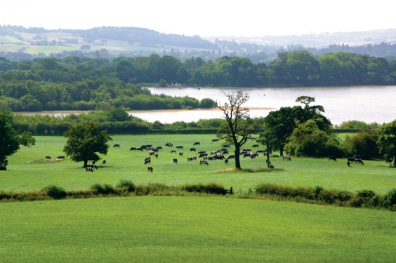
Pictured: These Green Belt fields separating us from Birmingham at Hopwood could fall to a Longbridge link road.
